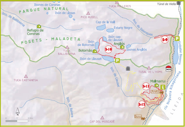
Barrabés sector is the easternmost of the Nature Park and includes the town of Montanuy, with 17 villages.
In this sector there are two entrances to the park:
- Forest track leaves the town of Aneto and reaches ibón Llauset.
- At kilometer 147 of the N-230, we will find a parking that gives access to Salenques Valley.
|
S-9. VALLE DE SALENQUES |
|
| Walk type: |
circular |
| Distance: |
3.850m. (to reach) |
| Estimated time: |
1h. y 45 min (circuito completo) |
| Elevation: |
196m |
| Description: |
We left the parking which is located in the N-230 near the bridge over the river Salenques, near the tail of the reservoir Baserca. We left the parking toward the reservoir and passed, if the water permits, under the bridge, taking the path that matches on this side of the river with the GR 11 (red and white markers) and climbs up the river on its right bank, through a lush forest with beech and fir trees. After 50 minutes on the way we reach the metal bridge that allows us to cross to the opposite shore to begin the return of the Left Bank. At this point we leave the GR 11 and our route takes us back to the bridge of Salenques by the way of 'solana'. |
|
S-10. LLAUSET IBÓN – BOTORNÁS IBÓN – ANGLIÓS IBÓN |
|
| Walk type: |
circular |
| Distance: |
8.000m. (to reach) |
| Estimated time: |
6h. (complete) |
| Elevation: |
345m |
| Description: |
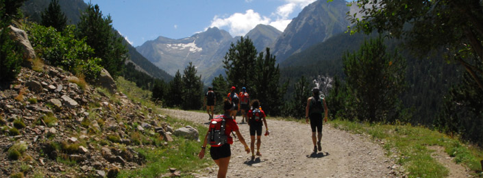
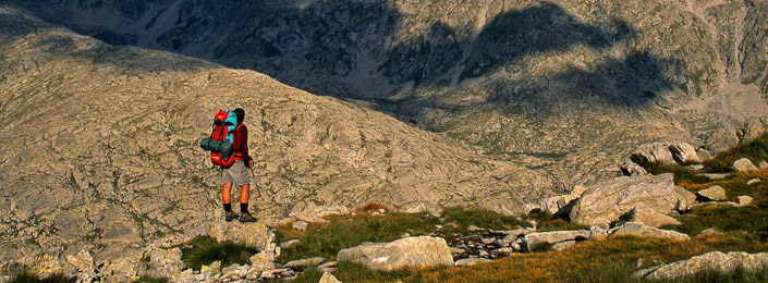
We start from Ibón of Llauset next to the dam at 2182 meters altitude. From the parking of the dam we cross the small stone tunnel and find directional signs to the different Ibones and the panel of the trailhead. Our trail continues along the front of Llauset ibón to head off toward the shelter of Botornás, located a few meters before ibón Botornás. After rounding this ibón the path climbs to the Cap de Llauset ibón and from there the route turns to the southeast up to the Coll dels Ibons. Once topped the hill the path descends through a chaos of stone blocks to reach the ibones first Anglian Cap and then are larger than ibones of East Anglia, close to where the shelter Angliós is kept. To return to the starting point must climb the Coll d'Angliós and once topped the path led back down to the shores of Ibón of Llauset. The whole route match with variants of the GR 11 (red and white markers) |
|
S-12. ANETO PUEBLO – TRAIL OF LA CREU |
|
| Walk type: |
circular |
| Distance: |
5.000M. (to reach) |
| Estimated time: |
2h. Y 30min (complete) |
| Elevation: |
150m |
| Description: |
The trail starts by the old road opened by the hydroelectric company Enher, from the village to the azud of Aneto Morelló Llauset in the ravine, in which route we will pass by the view over the valley of the Noguera Ribagorzana and enjoy a path with a varied vegetation. From the azud (1h.15 'approximately) the path back again to the village by the canal that carries water to the forebay of the power plant of Senet. This channel offers stunning views of the valley and a slight slope, but the difficulty is in the narrowness of some points and the risk of rock falls in rainy days as it crosses a narrow strip in a stunning cliff. Once we got to the loading chamber is important to stay on the beaten path and be alert to the signs. Continuing along the canal path leads us back to the bottom of the village of Aneto. |
|
S-13. ANETO PUEBLO – MALMARRUI TRAIL |
|
| Walk type: |
circular |
| Distance: |
5.550m. (to reach) |
| Estimated time: |
3h. Y 30min (circuito completo) |
| Elevation: |
245m |
| Description: |
To start this path will leave the village of Aneto and take the forest trail in the direction of Llauset Ibón. About 50 meters from the edge of the village took a path to our right heading north where we will find start signal path. We take the path and zigzagging up until reaching a flatter area of grass where we find the cabin Malmarrui, shepherds shelter recently rebuilt where we can shelter from a summer storm. We leave the hut and took west ascending the ridge to reach the highest point of our journey, from there follow the division and change of slope, continuing along the road signs until you come to a turn signal indicating Nestuy stables. We must be careful to follow our path marks that go down to get to a strip near the forest track. Following our tour we will arrive to coincide with the GR 11 (red and white markers) which continues down to find the asphalted forest road, crossing it at first and going for it on a sharp curve near the village of Aneto. |